A new paper accepted by Environmental Research Letters on 21 May 2026 projects that pyrocumulonimbus probability will increase across temperate southeast Australia under both low-emission and high-emission climate scenarios, with the largest gains concentrated in northern New South Wales and a temporal pattern in which near-term rises are more pronounced than far-future ones. The Ma and colleagues paper (with co-authors Sharples and Jovanoski) combines atmospheric profiling with NARCliM2.0 regional climate projections under SSP1-2.6 and SSP3-7.0, using the Continuous Haines Index and Fuel Moisture Index as the key environmental drivers. The result is a substantively different geographic picture from the one that has been driving Australian fire research and management investment for the past two decades.
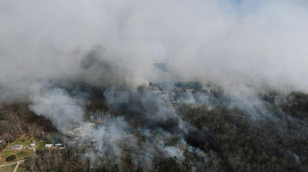
Pyrocumulonimbus events are the most dangerous wildfire phenomenon Australian emergency services contend with. The mechanism is straightforward and frightening. A sufficiently intense fire injects enough heat and moisture into the upper atmosphere to generate its own deep convective cloud. The cloud produces lightning that ignites new fires kilometres away, extreme wind shifts that change the fire ground in seconds, and pyroconvective downbursts that throw the rules of conventional fire behaviour out. Peterson and colleagues documented Australia’s Black Summer super-outbreak of late December 2019 and early January 2020 in npj Climate and Atmospheric Science (2021) as the largest pyroCb event yet observed, injecting approximately 1.0 teragram of smoke into the lower stratosphere. The Risk Frontiers report of February 2026 confirmed that the Walwa fire and several others in the January 2026 Victorian heatwave generated pyrocumulus and pyrocumulonimbus, producing lightning that ignited additional fires. The projection of rising probability is grounded in atmospheric profiling and physical mechanism rather than in extrapolation.
The Ma et al. finding that northern New South Wales sees the largest projected gains is the operationally important detail. Most of the Australian fire research and management investment over the last two decades has concentrated on Victoria and the southern New South Wales coast and ranges (with the Adelaide hills as a secondary focus). The Royal Commission into the 2019-20 Black Summer fires, the Victorian Inspector-General for Emergency Management reviews, the NSW RFS bushfire research portfolio, the Bushfire and Natural Hazards CRC’s signature investments, and the new Natural Hazards Research Australia centre have all weighted southern fire grounds heavily. Northern NSW has been a secondary research and resourcing focus. The ERL paper is a structural argument that the geographic concentration of the research and management investment has lagged the geographic distribution of the future risk. That is a serious resourcing argument for the next NHRA national research plan and for state-level fire agency strategy.
The second research strand published in the same week is more cautionary. Xu and colleagues, writing in an arXiv preprint on 14 May 2026, introduced WILDFIRE-FM, described as the first foundation model pretrained specifically for wildfire prediction. The substantive contribution is not the model itself. It is the demonstration that evaluation design and task formulation strongly influence which prediction model appears best in benchmarks. The authors built a fixed-contract evaluation framework with controlled checks for matching rules and prediction-head selection, then ran ten Earth-FM baselines through it. Different evaluation contracts produce different “winning” models. The finding is methodological. It says that benchmark performance and operational performance can diverge sharply depending on how the benchmark is constructed, and that purchase decisions made on benchmark headlines without scrutiny of the evaluation framework risk acquiring a model that scores well on the test but fails on the operational deployment.
A separate paper from Guyot and colleagues, published as an EGUsphere preprint on 18 May 2026, sharpens the operational caveat further. The paper studies satellite-based pyroCb detection algorithms and finds that they reliably identify the onset of extreme fire-driven convection, but progressively overestimate plume extent and persistence as the convective activity decays and advected anvil structures replace the actively convecting core. The mechanism is intuitive: a satellite sees cloud tops, and a decaying anvil is still cloud-top from above. The operational consequence is less intuitive: an automated satellite alert system can systematically over-warn during the late stages of a pyroCb event and create alert fatigue or trigger unnecessary downstream deployments. The authors quantify the divergence through centroid displacement and decreasing spatial overlap between satellite-derived and radar-derived plume objects. The recommendation is that real-time satellite alerts need to be supplemented with radar and lightning network data to avoid the late-event over-estimation. Relying on the satellite stream alone is the failure mode the paper documents.
Together the three papers frame a clear research-to-practice problem for any Australian fire agency procuring AI-driven prediction or detection tools. As pyroCb risk increases (the Ma et al. projection), the temptation to procure benchmark-leading AI tools will grow. The Xu et al. paper says that benchmark-leading is not the same as operationally robust. The Guyot et al. paper provides a concrete example of how the gap manifests in a tool that scores well on detection-onset benchmarks (a known strength) but fails on a different operational metric (plume persistence) that matters to emergency management.
The procurement implication is straightforward. Specifications for AI forecasting and detection tools need to encode operational tests alongside benchmark scores, with the operational tests treated as the decision-grade artefact. The next round of fire agency procurement should require a model card that documents the evaluation contract used to produce headline benchmark numbers, a separate operational test against a held-out Australian-fire-condition dataset, and an explicit statement of known failure modes (advected-anvil over-estimation being the obvious one for satellite pyroCb detection). This is the same procurement-specification argument I have written about separately in the wildfire decision support procurement gap and in the AI procurement rules tightening more broadly. The mechanics are familiar from other safety-of-life procurement domains: a benchmark works as a useful screening tool while the decision-grade artefact remains the operational test paired with the failure-mode documentation.
The broader AI-governance reading is the one I have written about across several recent articles. As AI tools enter operational decision support across high-stakes domains, the gap between the assurance question the regulator is asking (does this system pass the test?) and the assurance question the operational user needs answered (does this system hold up in conditions like the ones we will deploy it in?) widens. The wildfire-prediction case is one of the cleanest live examples of that gap because the operational conditions (pyroCb-generating fires) are rare, extreme, and not well represented in most training data. A benchmark built on the easier cases will fail on the cases that matter.
Buying an AI forecasting tool on benchmark results is the same shape of mistake as buying any other safety-critical system on the headline figures alone. The next round of fire-agency procurement specifications needs the second test built into the contract from the outset, with deployment-review evidence collected against the operational metric the tool was procured to support. The research is now clear enough to make the case for the change. The procurement timetable is the constraint that decides whether the case translates into the next set of tools acquired.
References
Di Virgilio, G. et al. (2019). Climate change increases the potential for extreme wildfires. Geophysical Research Letters.
Guyot, A., Vile, J., Soulard-Fischer, L., McGowan, H., Protat, A., & Poulsen, C. (2026, 18 May). Multi-sensor tracking of pyroconvection reveals discrepancies between satellite cloud-top detection and convective dynamics. EGUsphere preprint. https://doi.org/10.5194/egusphere-2026-1907
Ma, W., Sharples, J. J., & Jovanoski, Z. (2026). Projected changes in pyrocumulonimbus (pyroCb) occurrence probability under future climate scenarios over temperate southeast Australia. Environmental Research Letters. https://doi.org/10.1088/1748-9326/ae7131
Peterson, D. A. et al. (2021). Australia’s Black Summer pyrocumulonimbus super-outbreak reveals potential for increasingly extreme stratospheric smoke events. npj Climate and Atmospheric Science.
Risk Frontiers. (2026, February). Victorian bushfires, January 2026: pyroconvection observations.
Xu, Y., Dai, Y., Chang, L., Wang, Q., & Dong, Y. (2026, 14 May). Does Your Wildfire Prediction Model Actually Work, or Just Score Well? arXiv:2605.18911

Leave a comment